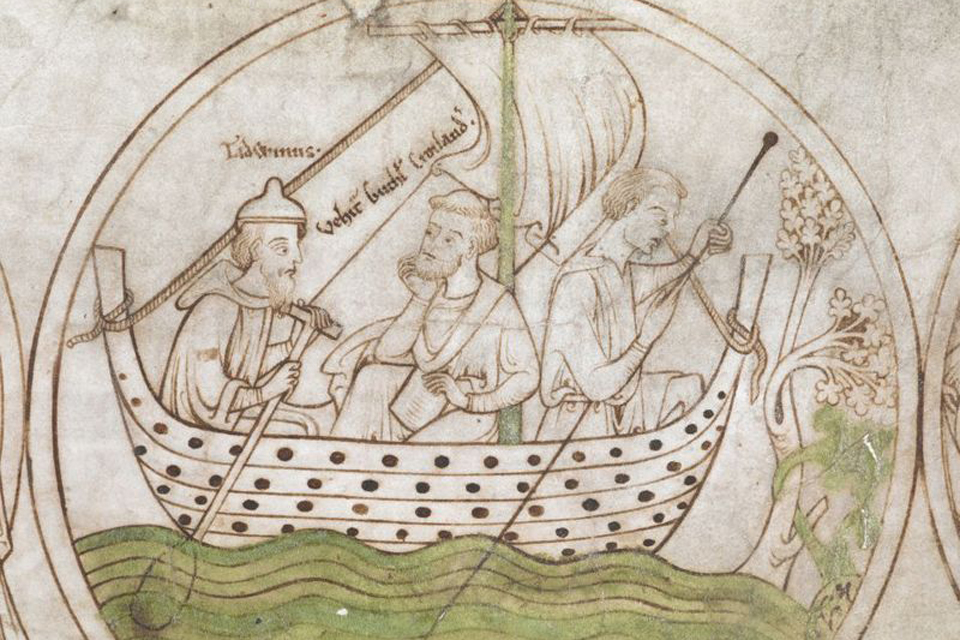
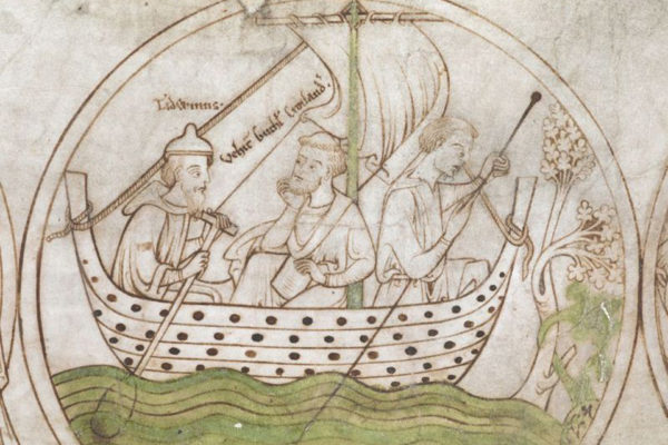
 http://www.medievalhistories.com/wp-content/uploads/Gutlac-punting-in-the-Fens-sailing-to-Crowland--500x333.jpg 500w,
 For a long time a number of research projects have explored the culturally fluid landscape of the Medieval Fenlands in Eastern England.
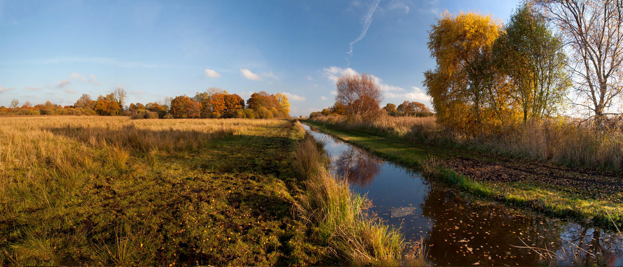
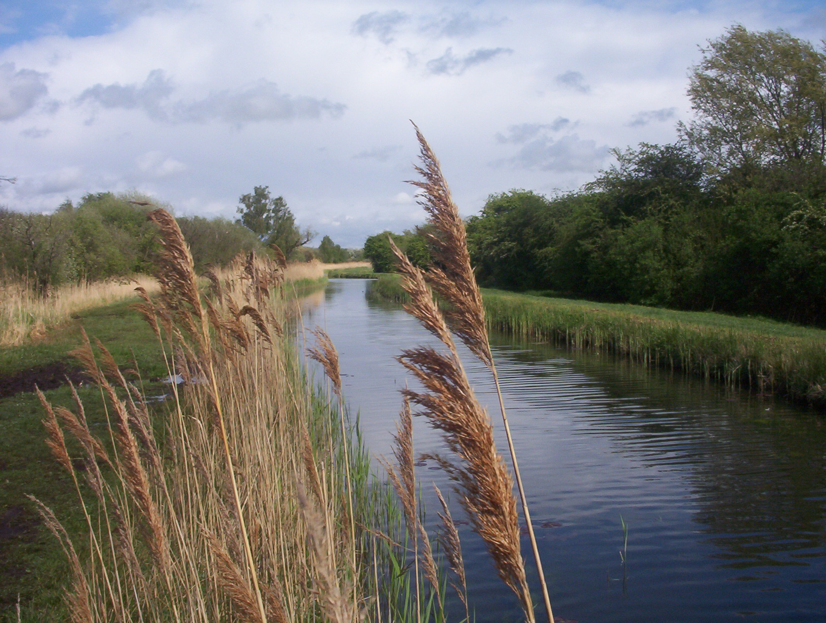 Lode in the Wicken Fens © Great Fen Project
East Anglia is generally a low laying land, much below the high tide sea level. Only one hard rock area can be found around West Runton. The rest of the coastline consists of soft sand beaches, dunes and not least washes and salt marshes licking the shores and estuaries of the many small rivers running into the North Sea. In the hinterland, drained fens have replaced former marshy sumps, with moorland and heath above the reach of the water.
Since the 17th century the Fenlands in East Anglia has been drained creating one of the most fertile agricultural regions in England. Unfortunately, this has also fostered a constant lowering of the land, which is now on average sinking between 1.5 -3 mm per year. Of course, the landscape is protected with a seawall. However, rising sea-levels combined with an increase in storms when tides rise to 3.5 meters and the increase of torrential rains have made living conditions more perilous. Especially, since the Anglian River Basin is not well fitted with sluices and dams designed to cope with flash floods. At the same time, land erosion is creating unsolvable situations for people seeing their homes fall victims to the foul weather.
The largest part of this landscape is the Fens, a naturally marshy region in northern East Anglia. The fens lie primarily around the wasp and are located on the borders between four counties, Lincolnshire, Cambridgeshire, Norfolk and Suffolk. It covers app 3.900 m2. Thus, it constitutes the largest single area of wet lowlands in UK.
The Fenland Basin was established through the erosive action of major rivers flowing through to the North Sea combined with rising sea-levels and the effect of the daily tides on average 1.5 m (with occasional tides reaching 2.4 m and exceptional tides 3.5 m).
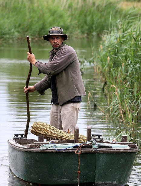 Peter Carter was the last licensed fisherman punting for eels in the fens. He ended 600-years family history in 2016. Source: Pinterest
Originally it consisted of fresh- or salt-water wetlands bordering the wasp and reaching inland to the peaty moors. The landscape thus consisted of the wash, the salt marshes, the fens and the moorland; much like the landscape bordering the north-sea coast across the channel from Denmark to Holland.
To forms of natural forces create such landscapes, with water inundating the land on a regular basis. From the inland flow rivers draining the hinterland into the sea. In spring such rivers will run especially high, heavy with sediment, which is dumped when the rivers hit the flat fens. Sand and clay will then clot up the river-ways forcing the water to find yet another route; and thus create a delta of waterlogged marshland. This leaves a landscape filled with sluggish canals choked with sediment, which again creates islands of peat heavy with rich marsh vegetation. However, this watery landscape would not only be created through water flowing from the inland. On a daily basis tidal water will create a salty marsh on the coast turning the landscape into a particularly fertile resource for grazing. However, on occasion stormy weather will foster tidal surges up to or more than more than 3.5 metres, flooding the landscape far inland.
Typically, settlements would be located on the higher ground on the fen edge, or on islands in the fens, yielding access to all the different types of resources: fenland, marsh and see. Other settlements were erected on wharfs in the marshes, proper. Communication upland was basically secured by transport on water, although projects to build inroads into the water-logged landscape was already initiated by the Romans resulting in a landscape characterised by wharfs (mounds), canals (lodes), landing places (hythes) and brackish lakes (meres). Since that time the rich grasslands and agricultural possibilities in the fenlands were intensively exploited. Marshland is naturally very rich and fertile due to the intermittent flooding during which nutritious sediments are left behind when the water withdraws. By diking, opening sluices and generally micromanaging the landscape, the Fenmen would control these processes securing the continuous and optimal fertility of the pastures and fields.
Traditionally, the exploitation of arable upland, seasonal pastures, salterns, fishing, fowling, trapping eels, basket-making and harvesting sedge and reed for thatching would contribute to the livelihood of the Fenmen. However, another important income came from grazing rights in the marshes. Typically calves would be raised in the back-land and then transferred to the marshes in order to be fattened for the markets further south. During other periods, sheep would roam the landscape.This was big business and the large abbeys and monasteries in the region were early on heavily involved in this. The rich system of canals and rivers supplied a vast system of waterways used for transporting surplus to markets in the hinterland.
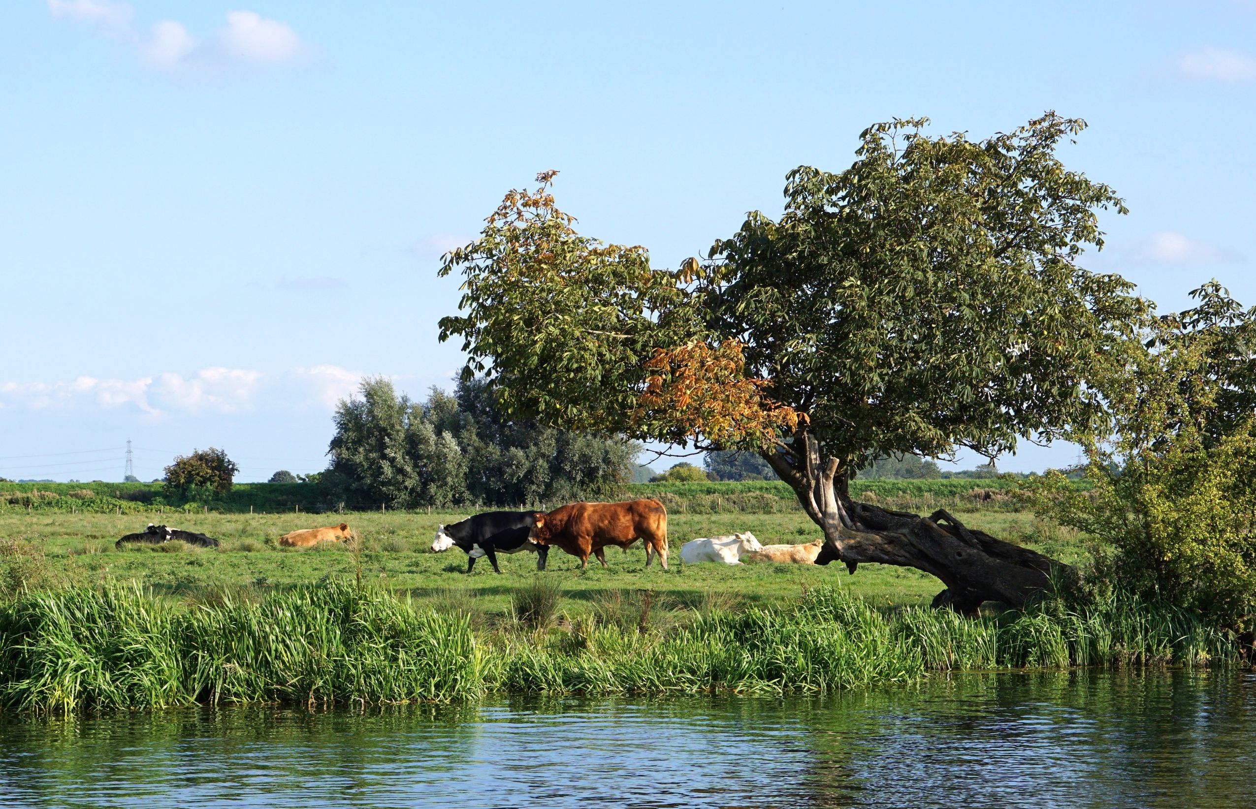 Riverside in the Cambridgeshire Fens © 123rf/Melanie Jones
Already, in the 1930s archaeological surveys of the early history of the Fenlands were initiated. It had become clear that centuries of drainage and cultivation had seriously reduced the archaeological deposits. These studies were among the first to take a multi-disciplinary approach to archaeological work, and continued in the 1980s when intensive surveys were made of the wetlands of Cambridgeshire, Lincolnshire, Norfolk and Suffolk.
During this period fieldworkers walked 250,000 hectares and initiated palaeo-environmental investigations allied to a radiocarbon dating programme. At the end of the survey, in 1989-90, the survey results were evaluated and a programme of field investigations undertaken.
Part of this project was to study and record archaeological and historical shifts in the exploitation of the fenlands, while registration of ancient agricultural practices and folklore continued alongside. The near-total loss of the wetland character of the landscape in the modern period made this project into a sustained effort of cataloguing the physical remnants of bygone days before the oldest Fenmen died out, who might still explain the old ways of living in and with the landscape.
In 1994, David Hall and John Coles published a synopsis of that work. Covering the whole period from the Mesolithic to Modern times, it provides an overview of cultural continuity and of the response to changing conditions over 6000 years of history it provides an introduction to the history of the settlements in the Fenlands. It was recently made available as an eBook.
SOURCE:
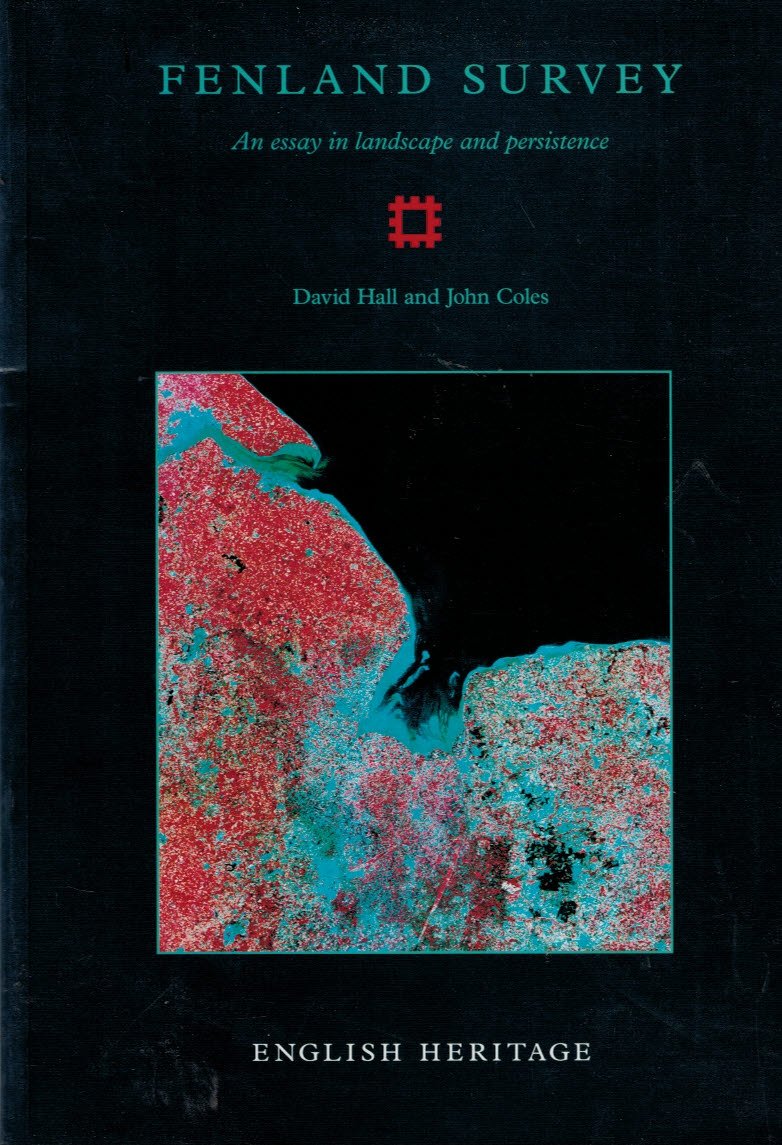 Fenland Survey: An essay in landscape and persistence
By David Hall and John Coles
English Heritage Publishing (1994) 2014
READ MORE:
 The Medieval Fenland
H. C. Darby
Cambridge University Press (1940) 2011
Originally published in 1940, this book, together with its companion volume The Draining of the Fens, constitutes an attempt to outline the changing conditions of a fascinating region. The text is ambitious in scope, reflecting the author’s position as a historical geographer, and covers a broad range of disciplinary perspectives, ranging from geology to socio-economic analysis. Numerous illustrative figures are contained, including maps, diagrams and photographs of the area, and a bibliography is also provided. Detailed, yet highly readable, this book will be of value to anyone with an interest in Fenland history and historical geography in general.
 From Punt to Plough: A History Of The Fens
by Rex Sly
The History Press 2003
ISBN-10: 0750933984
ISBN-13: 978-0750933988
 Rural England: An Illustrated History of the Landscape
Joan Thirsk
Oxford University Press 2002
ISBN-10: 0198606192
ISBN-13: 978-0198606192
 Waterways and Canal-Building in Medieval England
By John Blair
Oxford Scholarship 2014 (online 2015)
Print ISBN-13: 9780198723134
 Cambridgeshire and the Peat Fen: Medieval Rural Settlement and Commerce, c. AD 900 – 1300.
By Susan Oosthuizen
In: Medieval Rural Settlement, Britain and Ireland, AD 800 -1600. ed. by Neil Christie and Paul Stamper. Windgather, 2012, pp. 206 – 225.
 Liable to Floods. Village Landscape on the Edge of the Fens A D 450...
By J. R. Ravensdale
Cambridge University Press 2008
WEBSITES:
The Great Fen is a 50-year project to create a huge wetland area. One of the largest restoration projects of its type in Europe, the landscape of the fens between Peterborough and Huntingdon is being transformed for the benefit both of wildlife and of people.
The Fens for the Future Partnership is a group of public, private and voluntary sector organisations including local authorities, nature conservation bodies, farmers and landowners and academic institutions with a vision for the Fens
FEATURED PHOTO:
Punting in the Fens – Guthlac sailing to Crowland with Tatwin. © British Library, Harley Roll Y 6, roundel 4


Pentru a putea adăuga comentarii trebuie să fii membru al altmarius !
Alătură-te reţelei altmarius